-
Relevé de bâtiment numérique
-
Relevé CVSE
-
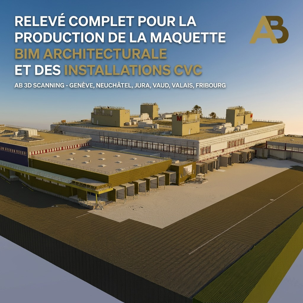
Maquettes 3D BIM LOD 400 – 500
-
Plans tels que construit CAD–2D , 3D (DWG, Revit, ArchiCad)
Nous travaillons à:
Genève Neuchâtel Valais Zurich
Vaud Fribourg Jura Bern
Nos Livrables
Scan to BIM / Maquettes 3D BIM
Scan to CAD, Plans tels que construits 2D, 3D (DGW RVT PLN)
Relevé et plans des installations CVSE
Façades, Ortho-images et vidéos
Nuages de points horodatés certifiés, Mesh Point Clouds
Cartes topographiques détaillées
Relevé des données du site en temps réel à partager avec les parties prenantes
Relevé des mesures, Calculs des volumes
Réalité-Virtuelle, Photos dynamiques 360 du projet
Comment 3D Laser Scan fonctionne ?

L’appareil (RTC 360 de Leica dans notre cas) utilisant la technologie LIDAR, capture 2 millions de points par seconde à chaque setup, créant progressivement un nuage de points de milliards de points. Chaque point a pratiquement des coordonnées. En parallèle, des photos à 360° sont capturées pour fournir un aperçu des couleurs.
Pour un bâtiment de 1 000 m2 par exemple, nous pourrions avoir besoin d’environ 200 setups et nous nous attendons à un nuage de points de 2,5 milliards de points.
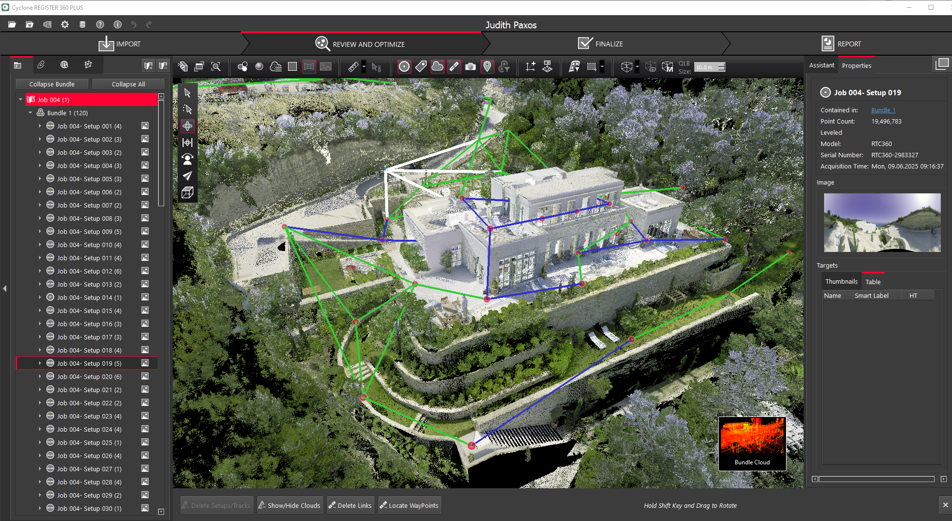
Des algorithmes sous logiciels spécifiques, combinés à l’expertise des utilisateurs, transforment les nuages de points en un modèle 3D précis et bien nettoyé, exempt de reflets et autres objets inutiles.
Par la suite, en fonction des livrables souhaités, d’autres logiciels sont appliqués afin de créer des: Plans CAD (DWG, ArchiCad et REVIT) maquettes BIM 3D, ortho-images, Réalité Virtuelle, visualisation des bâtiments en temps réel, ou encore jumeaux numériques.
Pour en savoir plus, visitez les sites suivants
Benefits of 3D Scanning / how it works Leica explains how 3D Scanning works LIDAR technology in a glance 6 Facts You Need to Know About 3D Reality Capture 3D Laser Scanning and Scan to BIM As Built Laser Scanning Workflow Digital Reality by Hexagon HxDr Lidar in AEC: overcoming obstacles and unlocking opportunitiesProjets récents